
Changes affecting all APIs
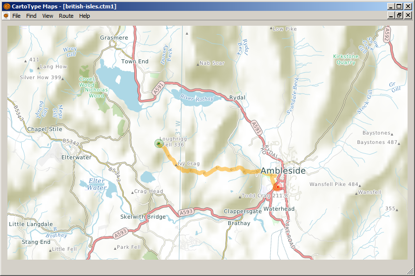
Gradients can be used in routing
You can add gradients to route data using the makemap command-line options /route=ag (A-star routing with gradients) or /route=cg (contraction hierarchy routing with gradients). For this to work you have to load the elevation data from USGS .hgt files using the /usgs option. For more details about the /usgs option see the main article about creating maps.
If you add gradients, one of eight gradients (flat or slight, gentle, steep and very steep, each in an uphill or downhill varient) is stored for every route segment. You can add speed weightings and bonuses to the route profile for the gradients, and specify which road types the gradient weightings apply to.
Loading and saving routes
Route objects now contain the route profile used to create them, which means you no longer have to specify a profile when saving a route. You can now load or save routes in files or strings, and you can load routes from GPX files, in which case the GPX track is converted to a legal route. All route loading and saving functions allow you to use either .ctroute or GPX format.
Layer names
You can get all the layer names in a single array using a new LayerNames or layerNames function.
Changes to the C++ API
Smart pointers
Functions creating objects (e.g., New functions, LoadMapObject) now return std::unique_ptr, not a raw pointer. This makes it much easier to manage their lifetimes.
String properties
String properties like Name, Locale and Proj4Param that were formerly returned as const char* are now returned as std::string, making it easier to write safe code.
Setting camera parameters in perspective view
The new SetPerspective overload takes a TPerspectiveParam object which allows you to set camera height, angle, rotation, field of view and other parameters.
Framework observers
Framework observers are now supported, primarily for use by CartoType GL.
Multiple framework observers are now supported: AddObserver and RemoveObserver replace SetObserver.
Changes to the Android Java API
Framework observers
Framework observers are now supported, primarily for use by CartoType GL.
Release 4.2 makes relatively few API changes. Its purpose is mainly to merge in a large number of internal changes from the main development branch.
Changes affecting all platforms
ReverseRoutes function
The new ReverseRoutes or reverseRoutes function reverses current routes, replacing them with new routes from the former end to the former start.
Changes to the C++ API
CMapObject
The CBaseMapObject class has been abolished. The public map object class is now CMapObject.
CMapObjectArray
There is a convenience declaration, CMapObjectArray, defined as std::vector<std::unique_ptr<CMapObject>> CMapObjectArray, which is used when returning map objects from Find functions. It replaces all former uses of CPointerArray<CBaseMapObject>. The use of unique pointers clarifies ownership and makes the objects easier to manage.
CBitmap
CBitmap functions which create modified bitmaps now return CBitmap objects, not std::unique_ptr<CBitmap>. There is no loss of performance because move operations are used internally.
Indication of turn-off
The TTurn class now has a member iTurnOff indicating whether is a turn off, defined as a turn on to a lower-status road.
Changes to the .NET API
MapObjectList
There is a new class, MapObjectList, defined as System.Collections.Generic.List<CartoType.MapObject>, which is used when returning map objects from Find functions. It replaces all former uses of List<MapObject>. One advantage of this change is that it allows documentation for Find functions to be shown in the Visual Studio Object Browser. Formerly, the presence of < and > signs in the C++/CLI type List<MapObject^>^ prevented in-source documentation for the Find functions from being created during compilation.
Changes to the Android API
Licensing functions
Two new functions, Framework.license and Framework.licensee, allow you to supply a license key and get the licensee name respectively.
deleteRoutes
The new deleteRoutes function deletes all current routes.
Release date: 27th July 2017
Previous release: 4.3, 21st April 2017
Summary of changes
You can use any shape to clip the results of searches for map objects, by providing a geometry object as the clip region. Geometry objects can be created from map objects and rectangles.
The route and route segment classes no longer contain route instructions. You can create them easily from any route object using a new function. This makes route calculation much faster; sometimes you want to create a route and show it on the map, but not create the instructions, and the last step is rather expensive.
There is now a function to get all the string attributes of a map object as a suitable aggregate such as a std::map (C++) or a sorted dictionary (.NET).
You can set the colors of icons and label text using map object attributes, and you can create icons consisting of a character or characters from an
icon font; such a font is provided: MapkeyIcons.ttf. The new style sheet attributes are:
- In <label> or <extraLabel>, the attribute colorAttrib names a map object attribute providing the label text color as a standard color specification as used in style sheets: a name, hex number starting with #, etc. If present, this color overrides the normal label color.
- In <icon>, font attributes can be used, like font-size and font-style, to set the font of a text icon.
- In <icon>, the attribute 'color' sets the icon color, colorizing it if it is normally a multi-color SVG icon, or setting its color if it is a text icon.
- In <icon>, the attribute 'colorAttrib' names a map object attribute providing the icon color. It overrides 'color'.
- In <icon>, the attribute 'text' provides a character or characters to be used as a text icon. For example, the character ''
(using the XML representation of the Unicode private-use codepoint U+E054) is
a camp-site icon in the MapkeyIcons font which is now supplied with CartoType. - In <icon>, the attribute 'textAttrib' names a map object attribute providing the character or characters to be used as a text icon. It overrides 'text'.
Changes to the C++ API
Nearly all plain enum types are now enum class, and have shorter names. For example, EFollowModeNone is now TFollowMode::None. However, in the most common cases, backward-compatible definitions have been provided, as for example 'constexpr TFollowMode EFollowModeNone = TFollowMode::None;' .
Some functions which in practice always returned KErrorNone now do not return an error code and are of 'void' return type. For example, CFramework::EnableMapByHandle.
The bit values TNavigationData::ETimeValid, etc., now start with K and are TNavigationData::KTimeValid, etc. The E prefix for enumerated values is being phased out, and these values are in any case constants, which by convention take the prefix K.
TFindParam::iClipCoordType has been abolished, and iClip is now of type CGeometry; CGeometry has a coordinate type. This means that all searches can now use a non-rectangular clip area. You can create CGeometry objects from TRectFP and CMapObject, or create them by adding points manually.
The new function 'std::map<CString,CString> CMapObject::GetStringAttributes() const' returns all the string attributes of a map object.
The CRoute class no longer contains route instructions. Use this function to get route instructions for the current locale: 'CString CFramework::RouteInstructions(const CRoute& aRoute) const' .
Changes to the .NET API
FindParam.m_clip_coord_type has been abolished, and m_clip is now a reference to Geometry; Geometry has a coordinate type. This means that all searches can now use a non-rectangular clip area. You can create Geometry objects from Rect and MapObject, or create them by adding points manually.
MapObject.GetStringAttributes() now returns a sorted dictionary mapping keys to values. It formerly returned a list of strings, implicitly treated as key-value pairs.
The Route class no longer contains route instructions. Use Framework.GetRouteInstructions instead. It gets instructions for the current locale.
Some functions which in practice always returned ErrorNone now do not return an error code and are of 'void' return type. For example, Framework.EnableMapByHandle.
Changes to the Android API
FindParam.iClipCoordType has been abolished, and iClip is now a reference to Geometry; Geometry has a coordinate type. This means that all searches can now use a non-rectangular clip area. You can create Geometry objects from Rect and MapObject, or create them by adding points manually. The multi-argument find() function has changed in the same way: its aClipCoordType argument has been abolished, and aClip is now a reference to Geometry.
MapObject.getStringAttributes() now returns a TreeMap mapping keys to values. It formerly returned a list of strings, implicitly treated as key-value pairs. The former functionality is still available as getStringAttributesArray().
The Route class no longer contains route instructions. Use Framework.getRouteInstructions instead. It gets instructions for the current locale.
Some functions which in practice always returned no error (0) now do not return an error code and are of 'void' return type. For example, Framework.enableMap.
Changes to the iOS API
CartoTypeFindParam.clipCoordType has been abolished, and clip is now a reference to CartoTypeGeometry; CartoTypeGeometry has a coordinate type. This means that all searches can now use a non-rectangular clip area. You can create CartoTypeGeometry objects from CartoTypeRect and CartoTypeMapObject, or create them by adding points manually.
The new getStringAttributes method of CartoTypeMapObject returns an NSMutableDictionary mapping keys to values.
The CartoTypeRoute route class no longer has a getInstructions method. Use the getRouteInstructions method of CartoTypeFramework instead.
Some functions which in practice always returned CTErrorNone now do not return an error code and are of 'void' return type. For example, setStyleSheetVariable.
Changes to the Maps App
The Maps App now allows you to set the colors of icons, and optionally choose a custom icon from the supplied icon font, MapkeyIcons.ttf.
Release date: 21st April 2017
Previous release: 4.2, 12th December 2016
Major changes since the previous release
Added a new routing system, turn-expanded A-star, which allows routes to pass through the same junction or road segment twice.
Added functions to set and get the preferred routing system and find out what the actual current routing system is.
Improved the system for allowing routes to pass along private highways at start and end, which was formerly unreliable and could cause slow route calculation.
The CFramework functions GeoCodeSummary and GetAddress no longer take a locale parameter. They use the locale set by CFramework::SetLocale; analogous changes have been made to the Android, .NET, and iOS SDKs.
Changes affecting the C++ API only
Abolished the CartoType-specific array classes CArray, CPointerArray, CNonOwningPointerArray, TFixedSizeArray. Standard library std::vector and std::array classes are now used instead of them.
Added functions CFramework::AbbreviatePlacename and ExpandStreetName.
Added the string class TWritableText, mostly for internal use.
The TTextLiteral macro now causes no code to be executed at run-time.
Changes affecting the .NET API only
The Geometry class now has functions to get the number of contours, number of points in any contour, the coordinates of a point, and whether the object is empty.
Changes affecting the IOS API only
The CartoTypeGeometry class now has functions to get the number of contours, number of points in any contour, and the coordinates of a point.
Changes to makemap
Many more projections are supported by the /project option, allowing you to use (for example) Lambert Equal Area with default parameters by simply using /project=laea instead of having to supply the full set of proj.4 options. The names are the same as those used in proj.4. The following projections are now supported: merc, cea, eqc, tmerc, tcea, cass, sinu, moll, eck1...eck6, goode, hatano, mbtfpp, mbtfpq, mbtfps, putp2, putp5, quau, winkl, boggs, collg, dense, parab, poly, hammer, wag7, aitoff, wintri, loxim, bonne, lcc, eqdc, pconic, aea, leac, rpoly, stere, sterea, gnom, ortho, airy, laea, aeqd.
A better memory allocation system gives about a 13% speed improvement when creating a CTM1 file from OSM data.
Some parallellization gives a further small speed improvement on multi-core computers; e.g., 3% on four physical cores.

Release date: 7th February 2018
Previous release: 4.4, 27th July 2017
Summary of changes
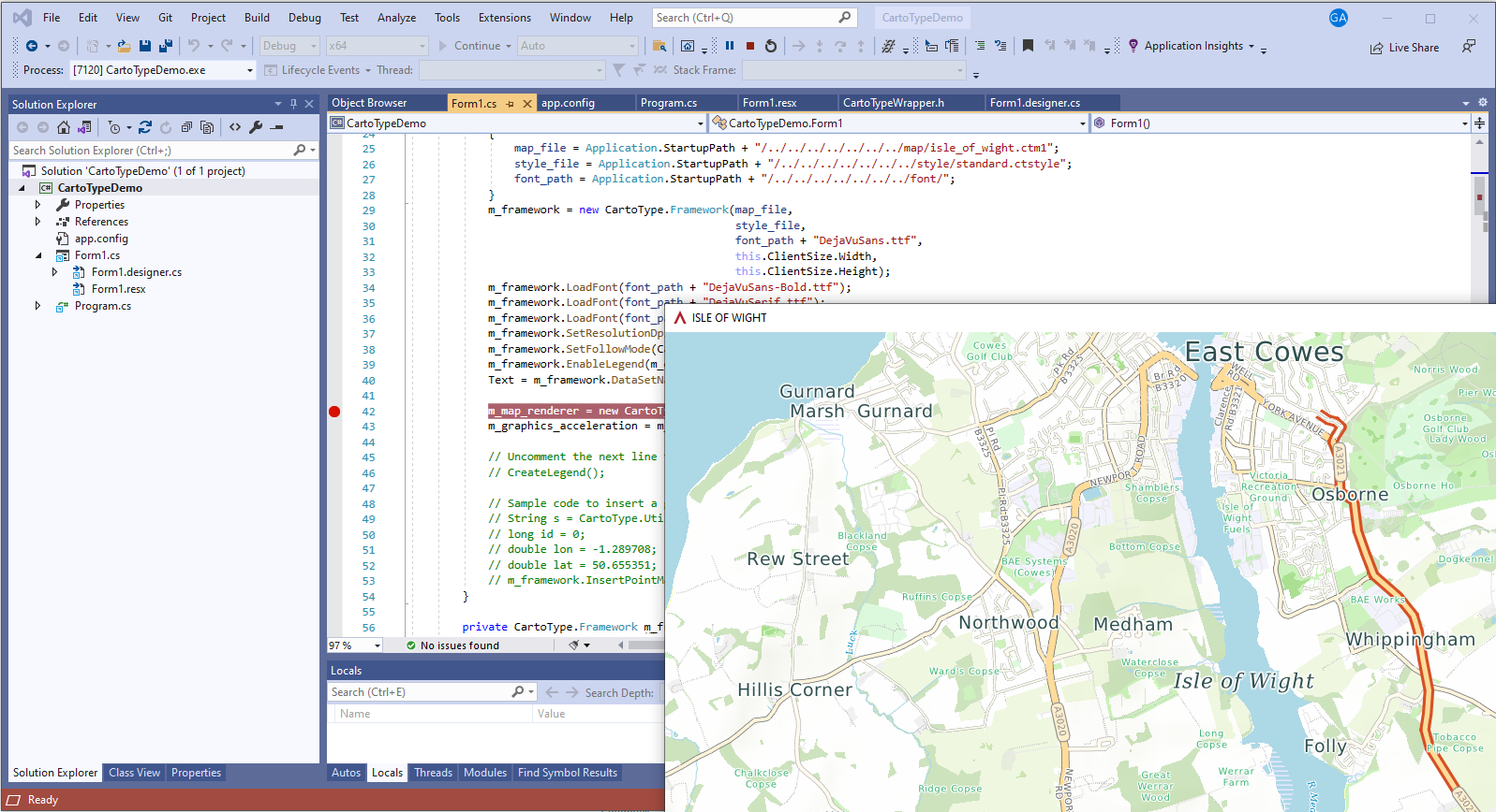
The graphics acceleration system known as CartoType GL is now incorporated into the standard version of CartoType. To use it, you create a CFramework object in the normal way, loading the map, style sheet and fonts, then create a CMapRenderer object referencing your framework. You can then draw the map at, for example, thirty frames per second, in response to a timer event.
The CMapRenderer class is a C++ class. For Android there is the Java class MapRenderer, and for iOS there is the Objective C class CartoTypeMapRenderer.
Graphics acceleration is available for iOS, Android, Windows (desktop), OS X (Macintosh), and Linux. It is available on the Qt framework for Windows (desktop), OS X (Macintosh) and Linux.
This release was made on 5th March 2021 and is based on mainline revision 9722. It is a major release with incompatible changes to APIs, which are detailed below.
The previous release, 6.2, was made on 5th September 2020 and was based on mainline revision 9241.
Tiled route data
The makemap tool can now split contraction hierarchy route data into tiles. Any subset of the tiled maps from a particular makemap run can be used together, and routing will work using the tiles that are present. You can load and unload maps at any time. Routing will use the tiles that are available. If you load extra tiles and recreate a route, the new route may be different because of the added route data. If CartoType can't create a route because of missing tiles you will get the 'no route connectivity' error.
This release was made on 13th May 2021 and is based on mainline revision 9870.
The previous release, 7.0, was made on 5th March 2021 and was based on mainline revision 9722.
Map object editing functions
There are new functions to make it easier to add interactive editing to a CartoType application. They manage the creation and editing of linear and polygonal objects by means of pointer presses and movements and allow the new objects to be added to any layer of the map.
The Maps App demonstrates some of the new functions using these actions:
This release was made on 27th July 2021 and is based on mainline revision 9961.
The previous release, 7.2, was made on 13th May 2021 and was based on mainline revision 9870.
Setting colors of map objects individually
It is now possible to give every map object that is a line or a polygon its own main color and border color, overriding any colors set in the style sheet. Formerly that was possible only for
icons. The new feature is principally useful when inserting map objects at run time ('dynamic map objects') but can be used when building the CTM1 file by inserting appropriate logic in the .makemap rules.
This release was made on 18th October 2021 and is based on mainline revision 10121.
The previous release, 7.4, was made on 27th July 2021 and was based on mainline revision 9961.
A new routing system with compact data
There is a new routing system, Turn-Expanded Compact. Use the option /route=tc in makemap. It requires much less run-time memory, but, unlike the contraction hierarchy systems, allows arbitrary route profiles to be set at run time. It is suitable for large areas such as the whole of the UK on mobile platforms like iOS and Android.
This release was made on 29th March 2022 and is based on mainline revision 10409.
The previous release, 7.6, was made on 18th October 2021 and was based on mainline revision 10121.
Added time/distance matrix function
There is now a function to return a time/distance matrix giving the route time and distance for all combinations of a set of start points and a set of end points. It is implemented for the turn-expanded contraction hierarchy /route=tech), turn-expanded (/route=t), and a-star (/route=a) routers. The fastest implementation by far is that for the TECH router, but that implementation does not support arbitrary run-time route profiles or dynamic road closures. The fastest flexible implementation, which does support those features, is that for the turn-expanded router.
There is a new makemap option, /hublabels=yes, which can be used in conjunction with /route=tech to add hub label data to the TECH route data to enable ultra-fast calculation of time/distance matrices.
This release was made on 5th July 2022 and is based on mainline revision 10787.
The previous release, 7.8, was made on 28th March 2022 and was based on mainline revision 10409.
This is a major release which introduces many source code incompatibilities. They fall into two categories: renaming of public identifiers, and the introduction of simpler and consistent feature types for map objects. The aim is to make CartoType applications easier to write, read and debug.
The previous release will continue to be supported until 31st July 2024 and will receive bug fixes but no new features.
This release was made on 9th December 2022 and is based on commit 8.2-57-g51a9fa561 in the new Git repository.
The previous release was made on 5th July 2022 and was based on CartoType-mainline revision 10787 in the Mercurial repository.
The main change is a great improvement to street address searching, using a new table in the map file.
This release, 8.4, was made on 20th February 2023 and is based on commit 8.4-1-gcb08c572d in the Git repository.
The previous release, 8.2, was made on 9th December 2022 and was based on commit 8.2-57-g51a9fa561 in the Git repository.
The main changes are the renaming of ctm1_info, the tool for describing the contents of a map file, to mapinfo; and some important changes to the standard style sheet.
This release, 8.6, was made on 8th August 2023 and is based on commit 8.6-1-gc0939f76f in the Git repository.
The previous release, 8.4, was made on 20th February 2023 and was based on commit 8.4-1-gcb08c572d in the Git repository.
The main change is the introduction of support for online map data.
CartoType demonstration applications
These programs are intended to show off the features of CartoType and help you decide whether the CartoType library could be a useful part of your software application.
By using the CartoType demonstration programs, maps or style sheets, however acquired, you accept the terms of the CartoType Evaluation License and you also accept that neither CartoType Ltd, nor any owners, shareholders or officers of CartoType Ltd, or any other contributors to, authors of or maintainers of the CartoType system, are liable for any damage, direct or consequential, caused by downloading, installing or using the demonstration programs, maps or style sheets, and that the demonstration programs, maps or style sheets are not warranted fit for any particular use and are for evaluation use only and may not be used for any commercial purpose.
Evaluation SDKs (software development kits) allow you to try out CartoType before you buy a license. You will be able to create a test application and find out whether CartoType is the right solution for you. The evaluation SDKs provide access to all functionality, including interactive map display, route calculation, address searching, and geocoding. API documentation is available on-line.
The CartoType evaluation SDKs (software development kits) are provided for evaluation only, excluding any commercial use. For commercial licensing please contact us.