
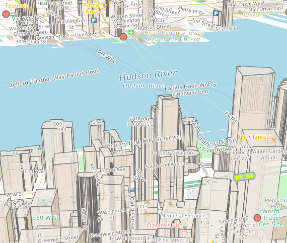
You can import and draw buildings in either 3D perspective, as shown above, or an orthographic '2.5D' view as shown below.
How it works
The makemap tool for creating maps (download the 32-bit Windows makemap or the 64-bit Windows makemap), imports the data from OpenStreetMap (see http://wiki.openstreetmap.org/wiki/Key:height#Height_of_buildings). You can see the effect working by downloading a map of new york state and loading it into the Maps App, then navigating to Manhattan.
We've added height='yes' to the building layer in standard style sheet, osm-style.xml, to enable the new feature, like this:
{code}
<shape fill='lightgrey+burlywood' opacity='0.8' height='yes' border='lightgrey+black' borderWidth='1'/>
{lang}xml{highlight}{end-code}
You can change the color, transparency and border of the buildings in the normal way. Two and a half D is used in standard mode, and 3D is used in perpective mode.

Limitations
These are experimental features and are not complete or perfect. For performance reasons, it's not always possible to draw the buildings in quite the right order, so sometimes a building that should be behind another one is drawn in front. Also, buildings made of of parts don't yet work perfectly. This is work in progress.