
CartoType supports writable map data, which means that unlike CTM1 maps it can be changed, edited and created at run time. Another name for this functionality is dynamic data. You can add map objects at run time,and you can make the data persistent by writing it to a file.
Dynamic data is stored in an efficient way so that you can be confident of good performance even if you add tens of thousands of objects to the map.
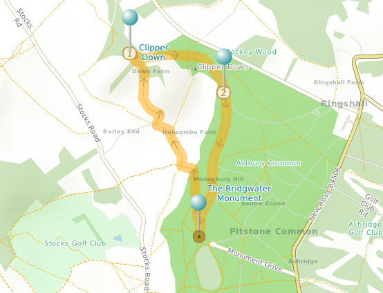
In the map above I've added two pushpins and a walking route to a map of southern England. The walk is one of my favourites.
I created the route using the Maps App, setting the route profile to 'Hike' and adding waypoints as necessary to create a circular walk.
Data formats
Data added at run time can be saved and loaded in various ways:
- GPX: a standard way of storing a track; often used by GPS devices
- CTROUTE: an XML format for CartoType routes
- CTMS (CartoType map data - Serialized): a simple binary format designed for CartoType data; use this for saving pushpins added at run-time
You can save and load these formats using the Maps App, and there are also CartoType API functions to do this