
You can use the makemap tool to create hill shading, and you can control its appearance in detail if you like.
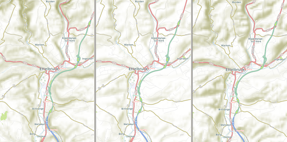
The middle image above uses the default settings: sun in the north west at an angle of 45 degrees, and a twofold height exaggeration (in makemap, the option is /sun=315,45,2). This is good for most purposes, and gives unobtrusive shading. The location shown, in Luxembourg, is hilly rather than mountainous, and the shading reflects that. Heavy shading can often interfere with other map features.
The technical details, if you're interested, are that the shade is calculated using Lambert's law, after multiplying heights by the height exaggeration factor, which is 2 by default. Then a saturation value is added to ensure that horizontal terrain is not shaded. Finally, to restore detail on slopes that have been washed out by the saturation stage, shading resulting from vertical illumination is added in a ratio of 1:3 compared to the main intensity value.
The left image uses vertical illumination and fivefold height exaggeration. The makemap option is /sun=0,90,5. It produces the same shading effect as finely spaced contour lines, and gives an unbiased impression of land forms. The disadvantage is greater apparent visual ambiguity between hills and valleys.
The right image again has the sun in the northwest (which is absurd for temperate latitudes in the northern hemisphere, but is an established cartographic convention), but at 30 degrees above the horizon, and with fourfold height exaggeration. The makemap option is /sun=315,30,4. The effect is to show relief in the same way as the standard settings, but much more boldly.
You can add shading by importing USGS height data.